Breakthrough of the Teplý potok (Warm Creek)
Contacts
Description
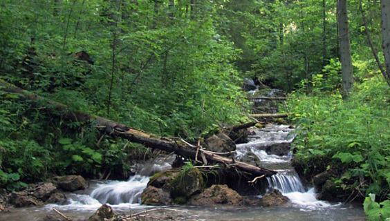
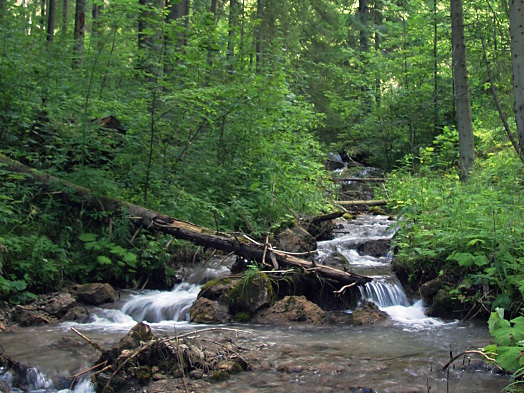
In the limestone and dolomite layers, a natural monument was created by the erosion of the water - Breakthrough of the Teplý potok (Warm Creek). It is a corner of Slovakia that not every tourist is aware of.** It is hidden in the Teplá dolina (Warm Valley)**, which belongs to the cadastre of the village of Liptovské Revúce.
The breakthrough of Teplý potok is a natural monument since 1984, and at the same time it is a unique morphological formation spreading out over the area of 21 ha.
This canyon-like section of Teplý potok with adjacent forest complexes and karst relief, travertines and erosion forms of the river flow stretches in length of about 180 meters and a depth of up to 20 meters.
Part of the protected area is also the lower waterfall of Teplý potok with a height of 2.4 m. It is accessible by a yellow marked trail in direction from the Teplá gamekeeper's house.
You may need some: accommodation Liptovské RevúceMap
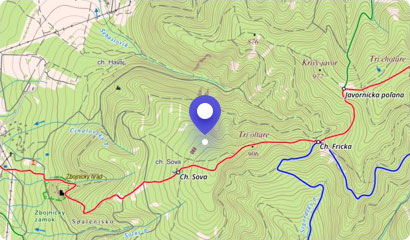
Tourist map (GPS 48.94763, 19.22434)
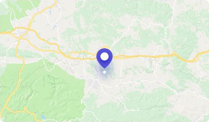
Google maps (Navigation)
Comments [0]
There are no comments. You can add comment or upload photos of this attraction.
Accommodation
Nearby things to do at Breakthrough of the Teplý potok (Warm Creek)
2.8 km
Water World Gothal
Lakes and pools
On the way between the villages of Liptovská Osada and Liptovská Lúžna, there is an exceptional place called Gothal. All the enthusiasts of nature, sports, tourism, skiin...
Liptovská Osada
3.6 km
Rakytov Hill - 1567 m asl
Hiking
Rakytov Hill is charming from near and far.It is one of the highest mountains of the Greater Fatra, from which you can enjoy wonderful views. The Rakytov massif itself is...
Ľubochňa
4.6 km
Skalná Alpa - 1463 m above sea level m.
Hiking
Skalná Alpa is a distinctive, sharp peak of the ridge of the Greater Fatra mountain range. It is situated between the villages of Ľubochňa, Liptovská Osada and Liptovské ...
Ľubochňa
6.1 km
Čierny kameň (Black Stone) - 1,479 m asl
Hiking
Black stone is certainly known to every tourist, it is one of the most visited mountains of the Greater Fatra. It is characterized by its sharp and rocky profile, which c...
Liptovské Revúce
6.3 km
Zvolen Hill - 1403 m asl
Hiking
The side ridge of the Great Fatra is complemented with the Zvolen hill, which is best visible from the village of Donovaly. Zvolen hill is a landmark and also a popular ...
Donovaly
6.6 km
Nová hoľa - 1361 m asl
Hiking
The Nová hoľa Hill in Greater Fatra is certainly very well known especially for winter sports lovers. On its southern slopes, there is a ski resort Park Snow Donovaly wit...
Donovaly
7.4 km
Brankovský Waterfall
Waterfalls
A trip to Brankovský Waterfall could be characterized as a simple hike / walk suitable for families with children. The waterfall is located in the beautiful Low Tatras, i...
Ružomberok
7.6 km
Bukovinka
Hiking
Bukovinka is an interesting location near Ružomberok, where there are several exsurgences and submersions that create a still living travertine hill. It is relatively lit...
Ružomberok