Description
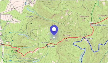
The north-west part of the Branisko mountain range is filled with Smrekovica, which is the highest peak of this mountain range. It rises above the villages of Vyšný Slavkov and Poľanovce. Smrekovica is a grateful tourist destination in any season.
The hike to the very top is very interesting and varied, but the imaginary cherry on the cake are just the views that will come from the top. You will have Spiš, Šariš, Levoča Hills and even Tatras during good visibility lie open.
The grassy-rocky surface of the peak offers ample space for a larger group of tourists. In addition, there is a cross, benches, fireplace and shelter where you can hide from the unpredictable weather.
The exit route leads through mostly dense forests and steep slopes, but in general, it is not very demanding, so everyone should handle it. Popular starting points include the Branisko ghaut (about 5 km), Vyšný Slavkov (about 5 km) and Šindliar (about 7 km).
You may need some: accommodation district LevočaMap
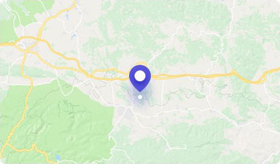
Tourist map (GPS 49.04592, 20.87078)
Google maps (Navigation)
Comments [0]
There are no comments. You can add comment or upload photos of this attraction.
Accommodation
Nearby things to do at Smrekovica - 1199 m asl
4.6 km
Lačnov Canyon
Hiking
In the Branisko mountain range in eastern Slovakia there is a locality that will remind you of Slovak Paradise in many ways. The locality is the Lačnov Canyon, which lies...
Lipovce
4.9 km
Lipovce Castle
Castle ruins
The ruins of Lipovce Castle are hidden in a dense forest on the ridge of Jazvečí Hill, which borders the village of Lipovce. The castle once served a guard function and h...
Lipovce
5.0 km
Gravitational anomaly in Lačnov
Other attractions
At the village of Lačnov near Prešov, there is a place where the law of gravity does not apply. It is a place that attracts rubbernecks from around the world literally as...
Lipovce
5.7 km
Zlá Diera Cave
Caves
Zlá diera Cave offers a mysterious tour of the underground near the village of Lipovce. It is the only known and only accessible cave in the Prešov district. The cave als...
Lipovce
5.7 km
Buče Hill - 1005 m asl
Hiking
Above the scattered village of Lačov, there is a Buče Hill attractive among tourists, which is part of the Bachureň mountain range. It is certainly known to all lovers of...
Lipovce
5.7 km
Rajtopíky - 1036 m asl
Hiking
The western part of the Branisko mountain range is filled with the Rajtopíky Hill, which is part of the nature reserve with the same name. It is quite an unidentified pla...
Dúbrava
6.2 km
Bachureň - 1081 m asl
Hiking
The picturesque mountain range of Bachureň, situated in north-eastern Slovakia in the districts of Sabinov and Prešov, offers pleasant and undemanding hiking in the bosom...
Lipovce
7.6 km
Mindzova - 920 m asl
Hiking
Bachureň is smaller, low and relatively less known mountain range. Despite this, it has hills in its collection that will not only offer you excellent hiking, but also al...
Lipovce