Description
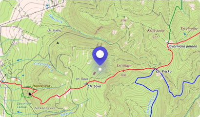
Part of the Slovak - Polish massif Červené vrchy (Red Mountains) on the northeastern edge of the Western Tatras is also Temniak Hill, which is sought-after among tourists. It lies directly in the main ridge between the peaks Kresanica and Polish Tomanová. Temniak Hill attracts mainly due to its good accessibility, but also with its characteristic rocky walls and cliffs.
Temniak is a nodal point of the main ridge of the Western Tatras, as well as an amazing viewing point. From its top, you can enjoy a view into the otherwise inaccessible to Tomanova Valley, where the footprints of dinosaurs were found.
The slopes of Temniak Hill, due to the fact that they are made of limestone, hide a number of cracks and caves, which are not accessible to tourists. An interesting feature of this hill is also that the grass on the slopes is colored in the red in the autumn.
On the top of Temniak, you can get off the hiking trail leading along the ridge of the massif of the Red Mountains. The starting point for hikes on the Slovak side can be the village of Podbanské. The route, however, is very long (about 15 km) but can be shortened if you take the cable car from the Polish side to Kasprov Hill, from where it is about 6 km. Slightly pleasant hiking trails lead from the Polish side from the Chuda Przełączka saddle.
You may need some: accommodation Pribylina - PodbanskéMap
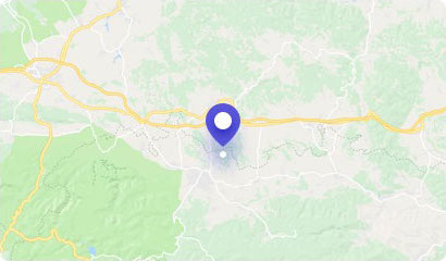
Tourist map (GPS 49.23074, 19.90314)
Google maps (Navigation)
Comments [0]
There are no comments. You can add comment or upload photos of this attraction.
Accommodation
Nearby things to do at Temniak - 2090 m asl
4.7 km
Tichá dolina (Silent Valley)
Hiking
Beautiful Tichá dolina (Silent Valley) is the first valley in the High Tatras, if you are coming here from the west. It is also the first among the valleys in terms of le...
Pribylina - Podbanské
5.2 km
Pyšné sedlo - 1791 m asl
Hiking
In the Western Tatras, where the Slovak-Polish border meets, lies the sprawling Pyšné sedlo (Proud Saddle). This alpine saddle is characterized by the fact that it is one...
Pribylina - Podbanské
5.7 km
Kasprov Hill - 1987 m asl
Hiking
in addition to heavily loaded hiking trails and exits to majestic peaks, our beautiful High Tatras have also their collection relatively simple and more or less relaxing ...
Pribylina - Podbanské
6.4 km
Bystrá - 2248 m asl
Hiking
Bystrá Hill is due to its beauty, diversity, but also the altitude considered the Queen of West Tatras. This spectacular two-thousander rises above the Račková, Bystrá an...
Liptovská Kokava
7.0 km
Klin Hill - 2173 m asl
Hiking
The massive, rocky hill of Klin with its typical pyramid shape is the type of hill you see from a distance. Its pointed peak and wide slopes will encourage you to make an...
Pribylina
7.5 km
Račkovo Saddle - 1958 m asl
Hiking
Račkovo Saddle is another of a series of large and grassy mountain saddles in the main ridge of the Western Tatras. It is situated on the Slovak - Polish border near the ...
Pribylina
7.8 km
Svinica - 2301 m asl
Hiking
On the border of Slovakia and Poland, there is a monumental and truly striking Svinica Hill. It is located on the main ridge of the High Tatras and is known to tourists e...
Pribylina - Podbanské
7.9 km
Račkova Valley
Hiking
Račkova Valley is a well-known locality of the Western Tatras for tourists, and therefore it is also frequently visited in every season. It has a length of more than 5 ki...
Pribylina